Middle Fork Trip Planning
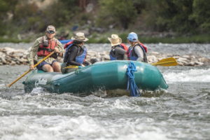
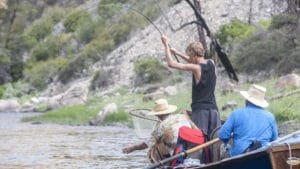
To plan a river trip, you need to do a lot of research and have access to many different resources. The Middle Fork of the Salmon River is one of the most beautiful, diverse, challenging, and famous river destinations in the world. People travel from all around the world to experience the spectacular Impassable Canyon and wet their lines in pursuit of native cutthroat trout. Depending on the water level, the river can be a raging whitewater hurdle or a technical maze.
One of the most important, and sometimes unnoticed, roles of a Middle Fork river guide is to respect and protect the incredible river resource. When you arrive at your camps they appear untrammeled, and you will encounter many delicate cultural and ecological specimens. The pristine nature of the Middle Fork is no accident, and it is important that if you are passing through the Middle Fork canyon without an outfitter you educate yourself on the Frank Church River of No Return Wilderness Leave No Trace Policy!
If you are not visiting the Middle Fork with an outfitter, here is some basic information to help you prepare for a private trip:
LOCATION & NEAREST TOWNS
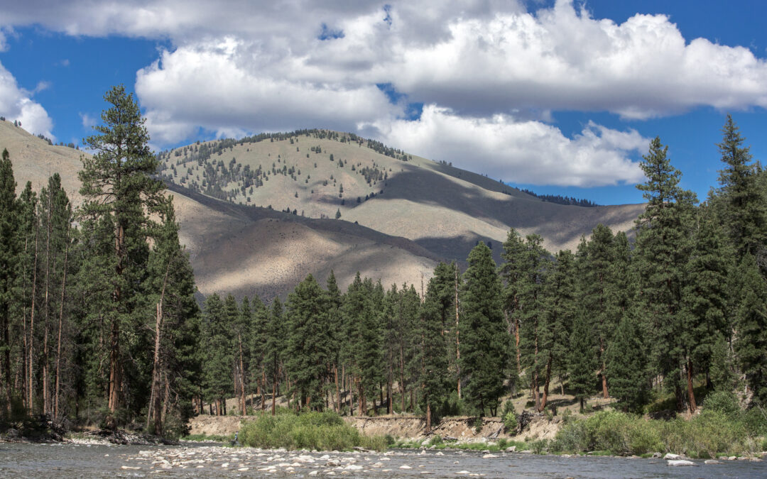
The Middle Fork of the Salmon River runs over 100 miles through the 2.3 million acre Frank Church River of No Return Wilderness. This is one of the most rugged and remote areas in the contiguous United States. The town of Stanley, ID is the closest jumping off point for people traveling to the Middle Fork. Riverwear, River 1, and McCoy’s Tackle are some stores in Stanley that are full of friendly people who have lots of information for boaters and fishermen/women. At the end of your trip, the closest major town to the take out is Salmon, ID. You can get your car shuttled to Salmon from Stanley using rivershuttles.com.
ACCESS
The two most common launch points are Boundary Creek/Dagger Falls Road (which is the only road access launch point for the Middle Fork), and Indian Creek (public airstrip at mile 22). The elevation at Boundary Creek is ~5,800 ft. The other two commonly used public landing strips along the Middle Fork are Thomas Creek (mile 33) and Bernard Cr. (mile 64). Indian Creek is typically used in the spring when the Boundary Creek road is still snowed-in or during extreme high/low flows. If you find yourself having to fly in to start your trip on the Middle Fork, you’ll have to load all of your gear, boats, and food into airplanes and pay to have them fly to Indian Creek. Remember – at this point you will be deep in the wilderness so there are no mechanical advantages allowed, such as wheelbarrows, generators, air blowers, etc.
SEASONS
The most popular time to float the Middle Fork is from late June to early August. The Highest flows are typically the first week in June, but flood stages can begin in May and last well into June on big snowpack years. The road into Boundary Creek usually opens around this same time of the year. You can call the Middle Fork Ranger District for road condition updates. Typically by the last week in July, the water is getting “low”, and by the end of August, a flight into Indian Creek to launch your trip may be the advisable choice. The Middle Fork is floatable through October, but ice becomes a potential danger in November.
To get a grasp on how to read the river gage (located at mile 32), click here: MY EXCELLENT RESOURCE PAGE FOR WATER LEVELS, FLOW PREDICTIONS, AND AVERAGE TEMPS ON THE MIDDLE FORK!!
PERMITS AND REGULATIONS
The Middle Fork is permitted and regulated by the Salmon Challis National Forest and the ID Fish and Game. To make a reservation, you need to go through the rec.gov system. Because there is significantly more demand than the regulated use capacity, you will need to enter into a lottery system on Rec.gov to be drawn for the date you want. Make sure to have your reservation in the lottery before December. Once you have your reservation confirmation, you need to get your permit at the guard station before launching for your trip. Don’t miss your meeting the afternoon before your trip at 3:30 when you select your assigned camps.
If you are fishing or hunting, make sure to observe all ID Fish and Game Regulations. You will need a license that you can buy in Stanley, ID or online at Idaho Fish and Game Online Licensing Page.
LEAVE NO TRACE!
The Middle Fork is in a Wilderness Area, as well as a Wild and Scenic River corridor. This means that it is regulated with a leave no trace policy. The Forest Service representative at your launch point will give you a briefing on the Leave No Trace policy. You will need a fire pan, groover, and a way to carry your trash with you.
RECOMMENDED READING
- The best guide book for rowing the Middle Fork is Matt Leidecker’s “The Middle Fork of the Salmon River: A Comprehensive Guide”.
- Another excellent history book is Cort Conley’s “The Middle Fork: A Guide”
- Salmon Challis National Forest’s Wilderness User’s Guide
If you decide a guided trip would be better for your group, contact us at Solitude River Trips for more information about our Idaho white water rafting and Middle Fork Salmon River fly fishing trips.